Author Archives: ads135

Open Dike Day

Have you ever seen inside a dike? After studying the history of Dutch dike building and design for some years now, I imagined something quite simple. Early modern design proposals and diagrams of dikes were common currency by the 18th century. Some focused on the dike bodies themselves, others showed the construction of protective revetments. While a few look inside the earthen dike body themselves, one is left with the impression that those constructions are precisely what one would expect, a core of sand or earth with successive layers of additional material pile d on top as necessity demanded. I have also come across a small number of diagrams from archaeologists who unearthed those layers, but they were few and far between.

Dikes in the Netherlands have a timeless quality to them. Despite their obvious connections to human management, they seem an almost natural part of the landscape. They’re a fundamental component of what the Dutch refer to as their “cultural landscape,” an environment intimately connected and, in fact, largely crafted out of human design. Dikes give order and structure to many cultural landscapes in the Netherlands and one of the oldest and best preserved regions that demonstrate this fact is West Friesland.

West Friesland lies in the current province of North Holland. Formerly a vast expanse of inland lakes and peat bogs, it is now a fertile (albeit still somewhat amphibious) medley of polders (drained remnants of former lakes), farmland, villages, and seaside towns. In a sense, it evokes the idyllic pastoral scenescape foreigners like me envision when they imagine the Netherlands. Sheep graze on green grass, small ditches create a charming checkerboard pattern of the landscape, and a few extant windmills round out the view. Hardly buried beneath this veneer, however, is a landscape equally derivative of disaster, social tension, and the struggle to manage the limits of an increasingly vulnerable landscape.

The central feature of the West Frisian cultural landscape is the Westfries Omringdijk, a large “encircling dike” that stretches 126 kilometers around the polder landscapes between the towns of Alkmaar, Hoorn, and Enkhuizen. Built over the span of centuries by connecting smaller dikes, it is a remnant of medieval, early modern, and modern dike techniques. The dike is a considered a cultural treasure (and a provincial monument) and is one of the few such dikes of such cultural significance.

Despite their importance as a repository of historical and cultural meaning, dikes are an understudied subject in the Netherlands. I was dumbfounded when Robert van Heeringen, an established archaeologist visiting the dig, explained to me that relatively few dikes have been completely excavated and a science on this subject has only recently developed. This state of affairs can partly be explained by their ubiquity no doubt. Dikes, particularly in the western third of the Netherlands and in the river lands, are virtually everywhere. Many of them are also still necessary components of local and regional flood defense. One cannot simply remove a section of interesting dike for study (one can’t do this anyway because of regulations prohibiting the removal of large amounts of earth in Holland). This explains my excitement when Michiel Bartels, a senior archaeologist in West Friesland invited me to an “Open Dike Day” near the town of Schardam.

I wouldn’t just see inside a dike, he promised, I would stand inside one. “What size boots do you need,” he asked? I had brought my own, but the opportunity to literally “get my boots muddy” (as Don Worster used to counsel his students) was fantastic. Historians don’t typically get to see, much less stand in the subjects of their research, though as environmental historians, we’re encouraged to take every opportunity to do so. This was my chance. I would meet Bartels at the West Frisian archive and then he would drive me to the dig.

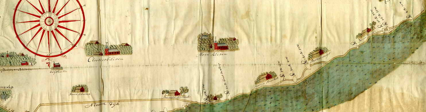
The opportunity to dig a cross section into a dike only comes along rarely. In West Friesland, archaeologists had already completed a dig near the town of Medemblik to the north, but opportunities generally arise only once every few years. The open dike day would feature a new dig made possible because the Hoogheemraadschap Noorderkwartier (water board of the north of Holland) planned to construct a new pumping station near Schardam. The dig site was called Lutjeschardam (little Schardam) because of the presence (seen on old maps) of a tiny village of the same name nearby. The village no longer exists and Bartels speculated that there may be evidence of the settlement set inland from the dike. Hopefully, he said, there would be an opportunity in the future to investigate the area, but it was not on the immediate agenda.

The dike itself was fascinating, partly because of its technological history and partly due to its social history. Land in front of the dike (called voorland) had continually eroded away over the course of centuries so that by 1298, the Holland nobleman Floris V instigated the process that would create the encircling Omringdijk. This was necessary because the increasing water level had combined with the sinking land in the area to increase flood risks. Many scholars term this process oxidation, but in fact, it’s a different process. When water is drained from a peat landscape, the resulting conditions increase the microbial activity in the peat, degrading it, which in combination with the increasing pressure from earth above, compacts the soil. This transformation is ongoing today and water authorities continually fight against these long term landscape changes.

SONY DSC

One section of the original Omringdijk was the dike section at Lutjeschardam, which if you look at old maps, is referred to sometimes as the Clamdijk. “Clam” in this case referring to conflict. As more and more land disappeared, the ring dike shifted inward and the Clamdijk was no longer a critical component of sea defense. In the middle ages, tension developed between the two water boards and their inhabitants who refused to pay for its upkeep. Eventually, the count of Holland was called in to mediate the dispute and he ruled that the waterboard of Drechterland (within the Omringdijk) was responsible because the Clamdijk had historically been a part of the encircling dike. History was a crucial component in these types of disputes and the heritage of the conflict lived on in its name.

The dike itself was the outcome of centuries of maintenance and expansion. It was a remarkably broad dike although it did not abut the sea. The cross section, excavated in a terrace-style manner, revealed layers upon layers of new additions. The core of the dike, Bartels explained to a local TV crew in the early afternoon, was constructed of clay and peat and stomped down by people and sleds, compacting it. Layers upon layers would be added later as the dike’s use changed. By the 17th century, inhabitants had begun adding debris to the mix, so you see a variety of odd pottery sherds, broken tobacco pipes, and animal bones. One of the volunteers helping clean the material showed me a pot sherd that originally came from Portugal. Portuguese salt was an important import because it was needed to salt Dutch fish (particularly herring) for domestic and international consumption. The white Portuguese salt pots with decorative blue glaze eventually found their way into the dike as well.  Earth is a prized commodity in a region where land sinks or erodes away, so it makes sense to fill gaps with whatever material becomes available.

Perhaps the most unique feature of the dig was the evidence of an early flood and dike doorbraak (break through). When dike breaches occurred, Dutch engineers employed a variety of efforts to reconstruct them, including sometimes sinking ships laden with stones in the breaches to plug the hole. Dike breaches occurred frequently in West Friesland and the winding trajectory of the dike in combination with what look today to be small lakes behind those curves is actually historical evidence of past disasters. When water overtops a dike, it scoured away the land immediately behind it (called a wiel). Today, if you ride on the bike path along the dike, you can read evidence of the disastrous past in the landscape itself. Back at Lutjeschardam, one of the project managers for the pumping station project joked that he was glad no ships had been found in the doorbraak because unless they “were made of gold,” it would have slowed the excavation and become a real problem for their timeline.

The only current pumping stations are on the northern and southern tips of the hoogheemraadschap, visualized in this map of water storage districts. The new station at Lutjescardam will be mid way up the region.

As the pumping project develops, this landscape will be irrevocably changed. In a sense this is unfortunate. This portion of cultural heritage will no longer retain its continuity. On the other hand, this open dike day would likely not have been possible without the construction. Archaeology West Friesland works hard (and incredibly fast) to excavate and understand these dikes when opportunities arise and this dig offered important new information for them. One might even conceive of this new pumping station as a fitting part of the larger history of this dike, always evolving with new technologies and new environmental conditions. This pumping station will be an important new element of water management in Holland because only two other stations in the entire region pump water out of the polders. At the same time, in a climate change future marked by rising seas and increasing likelihood of droughts in Holland, the pump can work in reverse to ensure that high value agriculture (like the tulip fields in the north) will have adequate water. The water board is planning far into the future, but at the same time, allowing scholars the opportunity to gain a clearer picture of the past.

Printing and Recycling – A Visit to the UvA Special Collections and the Rijksmuseum Print Room

Two years ago, the Dutch Studies institute at Columbia University began taking their summer paleography workshop to the Netherlands. Since 2007, this summer workshop has been one of the best opportunities for American students interested in developing a working understanding of reading 17th century Dutch manuscripts. Students would attend a week of classes hosted by Columbia University and organized by instructor Wijnie de Groot and University of Amsterdam professor Frans Blom. Even in its initial years, the opportunity was unique, partly because it was free and partly because few similar opportunities exist in the United States. In 2013, the workshop extended their program to the Netherlands and included workshops, tours, and events in archives and libraries in The Hague and Amsterdam. This international component was supported by the Wilhelmina Chair at Columbia as well as the Nederlandse Taalunie, an organization established to foster and promote the Dutch language.

I took part in the workshop at Columbia in 2013 and 2011, though I couldn’t participate in its Dutch program when it began my second year because I was already planning a research trip later in the summer. However, when the opportunity arose this year to join the group for a day at the University of Amsterdam bijzondere collecties (special collections) and the print cabinet of the Rijksmuseum in Amsterdam, I immediately jumped at the chance. I use the UvA bijzondere collecties regularly when in the Netherlands, but I’d never had the backstage tour that this group promised. Furthermore, I’d never seen any of the Rijksmuseum documents even though I often use the vast storehouse of open access documents available through the museum’s Rijksstudio.

The day began at UvA’s bijzondere collecties, easily one of the best repositories for early modern Dutch pamphlets, manuscripts, maps, and books. In the past, I’d been able to find documents related to each of my study areas, whether cattle plague, harsh weather, shipworms, or floods.  Our morning at the special collections would begin in the reading room and continue upstairs in the cartography department.

Paul Dijstelberge explains to the paleography workshop the printing process for early modern books and pamphlets.


Our presentations began with Paul Dijstelberge, a historian of the book at the University of Amsterdam with a deep familiarity with early modern print production and distribution. The unifying theme of the course had been the 17th century Dutch experience with the West Indies and China, so Dijstelberge presented a number of illuminated books, mass-produced pamphlets and other materials for the students related to those subjects. Although the print documents were fascinating, much of the focus was on the visual imagery employed in the documents, from ethnographic depictions of Chinese peoples to the 17th century bibles with beautifully inscribed maps of the Holy Land. This was also the first instance of what would become a reoccurring motif throughout the day, the importance of copying and recycling imagery.

Print production during the early modern period was not necessarily expensive (one could buy cheap pamphlets, for instance, for only a few stuivers) The more imagery one used, however, the more expensive a book became. The books with original imagery, (like Willem Barentsz’s accounts from Nova Zembla, for instance) would have been pricey and the most expensive documents had decorative bindings, more expensive paper, and gold inlay.

This print by Jan Smit in 1745 could not been recycled from previous prints and, in fact, was one of the few images that depicted this disaster.

In my work on disasters, I often run across imagery of crisis events and some, as in the case of floods, often seem disconnected from the events they portray. It has been an open question for me to what extent the imagery I use was specific to an event or whether it was mass produced and recycled. Some, like this sketch by Jan Smit (above) depicting the cattle plague epidemic of 1740s obviously arose in response to that event. Aside from being inscribed nae het leven (“after life” which was more of a sort of acknowledgement of the journalistic intentions of the author, rather than any statement of mimesis), the print depicts an event that was so rare, that it would not have made sense to reproduce it. That this is one of the rare depictions of cattle plague in Europe is further confirmation of its exclusivity.

A German engraving of the “almost unnaturally high flood waters” during the flood of 1717.

On the other hand, floods were not rare events and, indeed, their pervasiveness produced a virtual sub-genre of print production in the Netherlands and Germany. This print from a northern German almanac entitled Abbildung der fast übernatürlich-hohen Wasserflut am H(eiligen) Christ-Tag 1717 und am 25. Hornung (= Februar) 1718, for instance, has virtually no characteristics that might help scholars identify the location or time period. It may very well be the flood in northern Germany, it may be the same flood in Netherlands, or it may be a completely different flood borrowed from some previous publication recycled for use in the almanac. Recycling images, I learned during this excursion with the paleography group was a frequent occurrence, and not just in print production.

The staff of the cartography collection introduce us to some of their gems.

After parting ways with Dijstelberge, the group joined the cartography department for a similar primer, this time on 17th century Dutch cartography. That entire maps were plagiarized or stolen was no surprise. Much of the sudden ascendancy of the Dutch in the East Indies can be traced back to information clandestinely obtained from the Portuguese. This type of espionage was a common occurrence as states would pay handsomely for the new or more accurate sea charts of coastlines or sea lanes. They likewise copied inset depictions of coastlines or decorative scenes of allegorical or historical significance. Although the information or meaning contained in these decorations might not have offered significant mapping information, they were nevertheless recycled, not only between earlier and later editions of the maps, but also on completely different maps, sometimes of completely different areas.

The paleography group visits the Rijksmuseum print room.

Our final trip to the Rijksmuseum reestablished this trend. This final stop of the day with the paleography group took us to the print cabinet of the Rijksmuseum, an alcove accessed through the wonderfully elaborate library reading room. There, Rijksmuseum curator of prints Erik Hinterding introduced the group to a selection of prints that surveyed some of the cartographic and artistic gems in their massive collection. The highlights were undoubtedly the Rembrandt prints, a judgment half realized by merely looking at them, and half from the enthusiasm of our guide. Hinterding stressed the novel methods of print production pioneered by Rembrandt that both extended the lifespan of his engraved copper plates and allowed him the artistic license to continual reinvent his composition. This print by Rembrandt, entitled “The Three Crosses” demonstrates recycling without this innovation.

Rembrandt’s “Three Crosses” compared

The darker image on the right shows an earlier product from a fresh copper plate. The contrasts between light and dark are dramatic and in some cases profound enough to nearly envelope foreground figures and those behind the crucified Christ in near total darkness. After several prints were made, the copper was worn to the point that the image on the left seems brighter and the contrasts between light and dark not nearly so severe. In response to this challenge, Rembrandt used an innovative method of recomposing his images in his later prints, blacking out certain areas but not others, installing new figures or architectural details. In this way, Rembrandt could exercise imaginative changes to combat the wearing away of his tool.

This innovation reillustrates the challenges (and opportunities) facing early modern printing and image making. Why was recycling and reproduction such as important component of print making? Partly it stemmed from the nature and purpose of the printing craft. Prints were intended to be reproduced. Prints, especially elaborate prints made for books or maps were also expensive, so it made sense to make as many copies as possible. The limitations of print making meant that techniques leading to extended us were valuable innovations. Rembrandt’s facility, recognizable to even casual observation, extended to the craft as well.

Bienvenue à Bruxelles/Welkom in Brussel

There’s nothing like a conference presentation during your second day in a new country to get over jet lag. After a largely uneventful flight (thankfully) and a 4 hour layover between my arrival at Heathrow and boarding a train to the continent, I arrived in Brussels. Although I arrived on the 11th of June, my Belgian tussenstop really began about a month ago when Tim Soens, an environmental historian from the University of Antwerp, emailed me asking if I’d be willing to present some of my research at the annual Posthumus Conference. Coincidentally, I had already intended to pass through Brussels via train to Amsterdam that day, so it worked out perfectly to add another “layover” to my journey. I accepted knowing that I would be able to present work in a similar vein at the cultural resilience workshop that I would attend about a week later in Groningen. The opportunity seemed irresistible to present the work in multiple contexts, first among social-economic historians and second among cultural historians. I consider myself primarily an environmental and cultural historian, but my use of resilience as a conceptual tool, particularly as it relates to an invasive mollusk infestation in Dutch dike works, fits into the larger interests of European social economic history. Resilience is not a common subject in history at all, but nearly non-existent in cultural fields.

The Posthumus conference is an annual gathering of Dutch and Flemish social and economic historians, this year hosted by the Vrije Universiteit Brussel. A significant feature of the event is its balance between established scholars, junior scholars, and graduate students from the Low Countries. After two to three presentations, in keeping with tradition, research masters students are invited to offer 10 minutes of comments on the papers, and if presentations are from graduate students, more senior scholars offer “expert” comments. This seemed to be a fantastic training exercise (for the master’s students) and an opportunity for conference presenters to get some attentive feedback since the students would have access to the conference papers beforehand.

My own panel consisted of myself and Maïka de Keyzer, a postdoctoral researcher now at the University of Utrecht working on a project related to environmental change and social resilience. Maïka and I had presented together two years earlier at the annual conference of the American Society for Environmental History and, ironically, both of us were presenting in the same general topics, though in more refined forms. In my case, it was the difference between having research question with a few answers, to an established set of questions with significantly more evidence. Maïka’s presentation of her research on Medieval sand drifts in the Campine area of Flanders was concise and impressive, and her question and answer period reinforced those assessments. My own was likewise useful as I had interesting questions from the audience and thoughtful comments from the research masters student Ghamal Satya Mohammad, an Indonesian research masters student at Leiden University.

Rather than being followed by another paper, Tim Soens reserved the final slot on the program for historian Erik Thoen to introduce a new environmental history journal, The Journal for the History of Environment and Society. As Soens described it, our panel was a “teaser” for what was to be a central focus of the journal, in sum: “studies which focus on the historical relations between environmental changes and the social-historical context.” (from the mission statement) International and interregional studies will also be given special attention and it will be both online and open access.

This new journal is intended to be the successor to the Dutch-language Jaarboek voor Ecologische Geschiedenis, a wonderful Dutch language publication that featured impressive work from the early years of European environmental history in the 1990s until its final issue appeared in 2011. Unlike this journal which only included English-language scholarship in special contexts, the Journal for the History of Environment and Society will accept English, German, and French articles (the last two with extended English summaries). During the discussion period following its launch, many in the audience voiced their concern that the journal, whose focus is “on NW-Europe including areas that had histBossen in de Lage Landen (Jaarboek voor ecologische geschiedenis 2011)orical relations with that broad region” would be too restrictive in a field that seems to be reinventing itself to be the most global of historical disciplines. Thoen and Soens stressed that the journal would accept submissions from other regions as well, though this didn’t placate the audience. The journal has already taken leap in the right direction by offering a multi-lingual journal, thus making it accessible to a much broader base of scholars. In my own experience for instance, American environmental history is little aware of scholarship in the Netherlands or Germany where much fascinating work is being produced in their native tongues. English is already the international language of scholarship, but this new journal seems to be building necessary bridges for continental scholarship to reach a broader Anglo audience and vice versa.

I’m much more ambivalent about the geographic limitations of the mission statement than the critics at the journal’s launch. Environmental history can no longer be called a “new” field, but our increasingly established pedigree has not translated to a diverse outlet for scholarship. In a sense, this has been beneficial. With only so much space in the Environmental History and Environment & History, it makes sense that they would gravitate toward inclusiveness. An additional benefit is that EHers have been more or less forced (though I expect many welcomed the opportunity) to operate as apostles in other scholarly venues. One additional journal will not change either of these conditions. JHES will be a welcome option, particularly for those of us interested in the North Sea region.

Which leads us back to the chief criticism of the journal and the more interesting question of the future of regional or national scholarship in an increasingly international field. Frankly, I’m surprised that there are not more environmental history journals (or even newsletters) associated with specific areas of interest or geographic regions. Perhaps an envirotech or war & environment journal would be unsustainable, but a journal focused exclusively on Canadian, German, Chinese, or Australian environmental history seems more practical. Feasibility aside, however, what is to be gained? More venues won’t necessarily yield better scholarship, and it may not even increase the visibility of the field if fewer of us publish in outside journals. This reversion to national or regional histories seems at odds with ongoing trends in the discipline privileging transnational or international perspectives (largely a positive considering how much EH was weighted toward particular areas in the past). The JHES will have to toe a fine line as they move forward, but their initial steps seem very promising.

Research Journal Summer 2015

“Make sure to keep your summers for research.” This was the last advice I received from my advisor as we sat down to enjoy a celebratory, final dinner in Lawrence following my defense and graduation. Writing and research, I thought (which at times seem like an afterthought amidst the grading, prep, and lecturing responsibilities of the semester) would be a welcome change. At that point in late spring, I already had a full slate of conferences and research trips planned for the summer and as I later sat down to organize my research schedule, it dawned on me how intensely busy I would be in July. A number of day trips to archives and libraries of course, but also weekend visits with scholars and friends, workshops, conferences, and excursions awaited and those responsibilities (and opportunities) only increased over the ensuing month. The greatest risk of a full research schedule, I knew from past experience, is the inability to sit down and think about the importance (or insignificance) of one’s activities. This had been a problem for me in the past when I did not try to keep a record, and only after returning to the States and following an (oftentimes) lengthy decompression period, did I try to make sense of my visit. In an attempt to maintain some semblance of organization, a record of my experiences, and some necessary perspective, this is the first of several posts I plan to as a sort of ongoing debriefing exercise.

The National Archive of the Netherlands in Holland is a fantastic place if one is interested in Dutch military history, international relations and commerce, national crises (like the shipworm epidemic), and the Dutch on the global stage.

A little context here may be useful. As a scholar of Dutch environmental history and the history of disaster, I spend much of my time abroad in the libraries and archives of the Netherlands. My dissertation, called “Floods, Worms, and Cattle Plague: Nature-induced Disaster at the closing of the Dutch Golden Age” investigated the environmental, technological, and cultural significance of disaster in the early eighteenth century. Disaster, as has been argued by numerous historians including myself, was a formative condition of early modern Dutch history, and the study of this fascinating topic has led me along seemingly divergent paths, from pandemics of cattle plague in the meadows of Holland, to an invasive mollusk outbreak in coastal dike works, to one of the largest floods in North Sea history. It’s introduced me to fascinating work from friends and colleagues who study other regions and time periods, often also dealing with disaster and cultural change. Finally, it’s given me the opportunity to return to the Netherlands nearly annually over the course of my graduate career (a situation my partner reminds me isn’t really all that bad). Much of this time has been spent exploring the archives and libraries of the Netherlands that house documentation of disastrous circumstances.

From June 11 until July 12, I will be working, largely in the Netherlands. Interspersed with short research trips throughout the Netherlands, I will be attending the several conferences and workshops including the Posthumus conference in Brussels, Belgium, the Conference of the European Society for Environmental History in Versailles, France, and a Workshop on Cultural Resilience in Groningen, the Netherlands. This series of blog posts will document these experiences as well as findings from archival trips.

“Conservation” the real theme of ASEH 2015? Evaluating Voyant

It seems inevitable after every major conference that discussion quickly turns from the relative merits of the previous days’ panels, papers, and presentations to the event as a whole. Was the conference a success? What were the major trends during the conference? Which schools were most heavily represented? Which subjects received the most attention and which seemed strangely absent? Oftentimes, these discussions consist of vignettes and impressions and generally self select for the topics and time periods most regularly attended by discussants. Following the recent Annual Conference of the American Society for Environmental History, for instance, a group of KU scholars held an informal debriefing session for those who couldn’t attend the conference. We noted the strength of maritime history, the prevalence of sustainability as a core concept, and the relative lack of non-20th century and non-US presentations. As useful as the exercise was to gauge others’ opinions about the event, many of us went to the same panels and even our collective impressions could not begin to capture the breadth of the conference.

Environmental historians have also experimented with podcasts as a way to expand beyond the limitations of self-selecting departmental or informal exchanges. The Network in Canadian History & Environment (NiCHE) podcast entitled Nature’s Past: Canadian Environmental History published a retrospective appraisal from seven participants of the second World Congress for Environmental History in 2014 in Guimarães, Portugal. The podcast panelists came from various institutions in Canada (and one from the UK) and included one PhD candidate. Like more informal exchanges, the panelists tended to focus on core themes related to their interests and the diversity of voices in this discussion brought an impressive degree of breadth as well.

Depth is the strength of both informal and composed conference debriefings, but especially for those of us without decades of repeated attendance at these conferences, breadth is often wanting and the “trends” frequently discussed during these debriefings seem to exist outside of time. Can we say with any specificity when, for instance, “sustainability” or “the anthropocene” entered the discourse of these meetings, or more importantly, how they’ve changed over time? These are interesting questions because they reflect the growth, maturation, and development of the field. With the right tools, it may be possible to map out these trends.

As part of my exploration of online text analysis tools, and using the digital archive of ASEH conference programs (which extend back to 2003) I will begin working through this material, beginning with the 2015 program in DC. Using one conference program will not offer insight into multi-year trends (this will be addressed in future posts), but it will offer a chance to explore some of the strengths and weaknesses of using voyant tools for such a limited amount of data.

From  just a cursory evaluation of one conference program we find very few surprises. Naturally, “environment” (85) and “history” (51) dominate in total word count. These are quickly followed by “Georgetown,” (32) the host of the conference, “American,” (27) and “conservation” (22). If one polled participants about which terms might be the top five most likely words to appear in the conference program, my hunch is that these might be some of their choices (with conservation perhaps the exception). At the same time, this “top five” is also somewhat misleading. Voyant cannot differentiate between words used in one context or another. “Georgetown” was the name of the host university, but also the name of two rooms used by the conference. In reality, 18 of the 32 uses of “Georgetown” referred to the room rather than the school.

This type of problem extends to other schools as well. If one were curious  about university participation in the conference, for instance ranking it according to number of appearances in the program, voyant is a somewhat clumsy tool. (see list below) “Pennsylvania,” which occurs 14 times, might refer to The University of Pennsylvania (7), Pennsylvania State (3), of Pennsylvania State-Berks (2) or be included in conference papers, posters, etc. Voyant seems to offer a snapshot of some of the most heavily represented state names in the program, but this shouldn’t be mistaken for institutions. “Washington” might refer to one of three schools attending from Washington state or Washington University in St. Louis and “York” might refer to  York University (3), NYU (7), SUNY at Stony Brook (1), CUNY (1), or SUNY at Binghamton (1). These are common problems when working with this tool and it’s one of the main reasons why it pays to have a large corpus for analysis. At the scale of one conference program, this type of information is easily gleaned using simpler tools.

On the other hand, voyant offers a useful global perspective on even a relatively small corpus like this. I expected “conservation” to be a prominent subject considering its traditional importance in EH, but I would not have expected it to be the fifth most used, more prominent than “nature,” “environment,” “water,” or even “policy” (ostensibly the conference theme). What might this focus reveal about the state of the conference more broadly? Voyant does not offer ready explanations on this scale.

The global perspective on a small corpus like one program is also its chief drawback. It is difficult to parse any convincing relationships with so little data.  Voyant’s reputation relies less on its visually appealing word clouds than its ability to visualize word relationships using a number of supplemental tools. For instance, one can use the “word trends” tool to chart the frequency of a term against others over time (in this case, segments of the conference program), but this can lead to as many false associations as positive ones. For example, “Wisconsin-Madison” and “marine” show surprising symmetries across the program, indicating a possible relationship.

Does this indicate that Wisconsinites disproportionately favored topics in marine history? In fact, no papers or posters dealt with marine topics. This apparent relationship may have been random, or it may have been the result of some other factor not included in the analysis. Another Voyant tool graphs “correspondence” between terms on a scatter plot, identifying potential spatially organized clusters of word relationships.

Once again, this visualization shows several potential relationships, though none of them strong. Some more obvious relationships include “climate” and “change,” “american” and “west,”  and “protest” and “activism,” which appear clustered together. “Science” and “technology” is somewhat less closely clustered. “Pennsylvania” and “water” are also spatially clustered, but only one participant from a Pennsylvania school presented a paper on a “watery” topic (Jason M Chernesky’s “Amusement, Health, and the Therapeutic Environments on the 19th-Century Delaware River”) and “water” was not even included in the title.

On the scale of one program, therefore, we see the benefits and problems of using voyant as a tool of analysis. Voyant quickly and easily offers a global picture of the conference based on word frequency. The takeaway from the KU post-conference debrief was that “sustainability” and “marine” topics were surprisingly common. “Marine” appeared a respectable 13 times, but “sustainability” only had 4 mentions. None of us mentioned the prominence of “conservation” as a topic (and one our own even presented on it). Voyant’s mastery of breadth here offered an interesting new look. This might inspire someone to take a close look at, for instance, what sorts of conservation topics participants presented on during the conference. Were they progressive era or later twentieth century? Did they discuss terrestrial or marine conservation? American or non-American? Voyant could offer insight into these questions as well, but it would likely be a clumsy tool compared to more direct approaches.

Universities (number of mentions):

  1. Georgetown (12)
  2. Harvard (9)
  3. Wisconsin-Madison (8)
  4. University of Pennsylvania (7)
  5. New York University (7)
  6. California-Berkeley (7)
  7. University of Oklahoma (7)
  8. Pennsylvania State (5)
  9. University of Virginia (5)
  10. California Santa-Cruz (5)
  11. Washington (5)
  12. Michigan State (5)